Sandford, Indiana
Sandford, Indiana | |
|---|---|
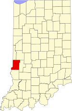
 Vigo County's location in Indiana | |
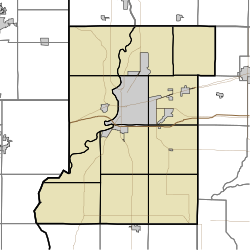
Location in Vigo County, Indiana | |
| Coordinates: 39°32′43″N 87°31′50″W / 39.54528°N 87.53056°W | |
| Country | United States |
| State | Indiana |
| County | Vigo |
| Township | Fayette |
| Elevation | 630 ft (192 m) |
| Time zone | UTC-5 (Eastern (EST)) |
| • Summer (DST) | UTC-4 (EDT) |
| ZIP code | 47885 |
| Area code(s) | 812, 930 |
| FIPS code | 18-67824[2] |
| GNIS feature ID | 442999 |
Sandford is an unincorporated community in Fayette Township, Vigo County, in the U.S. state of Indiana.[3] The community is part of the Terre Haute Metropolitan Statistical Area. A small portion of Sandford, now known as West Sandford or “Stringtown”, is in Illinois.
History
[edit]Sandford was established in 1854 at the state line between Illinois and Indiana. With the building of the Indianapolis & St. Louis Railroad, it became an important town in the area. In 1890 it had a population of approximately 250.[4]
A post office was established at Sandford in 1855, and remained in operation until 1995.[5]
On Jan. 19, 1907, at least 30 people were killed when nitroglycerin exploded in a freight car as a passenger train passed.[6]
Geography
[edit]Sandford is located at 39°32′43″N 87°31′50″W / 39.54528°N 87.53056°W.
References
[edit]- ^ "US Board on Geographic Names". United States Geological Survey. October 25, 2007. Retrieved January 31, 2008.
- ^ "U.S. Census website". United States Census Bureau. Retrieved January 31, 2008.
- ^ "Sandford, Indiana". Geographic Names Information System. United States Geological Survey. Retrieved August 7, 2017.
- ^ Bradsby, H.C. (1891). History of Vigo County, Indiana, with Biographical Selections. Chicago: S. B. Nelson & Co. pp. 481.
- ^ "Vigo County". Jim Forte Postal History. Retrieved July 14, 2016.
- ^ "Sandford offers more than first meets the eye". Terre Haute Tribune-Star.


